Paths of Apokoronas (Route 1)
Route 1 : Aptera, between water and air
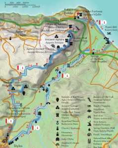
Kalami - Itzedin Fortress - Kyani Akti - Vlychada Springs - Platanakia - Kalogeri watermill- Stylos - Panagia Zerviotissa - Minoan tomb of Azogyre - Aptera - Subashi Tower
Total length 12.8 km, estimated time 4h 15΄

Part A: Length 7.5 km, estimated time 2h 25΄
Kalami - Itzedin Fortress - Kyani Akti - Vlychada Springs - Platanakia - Kalogeri watermill- Stilos
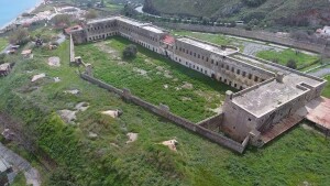
This route is one of the two that connect the Municipalities of Chania and Apokoronas, passing through significant monuments, combining elements of history and culture with impressive alternations of the landscape. The starting point of this route is the settlement of Kalami at the western end of the former province of Apokoronas, which is part of the Municipality of Chania since 2010. Acknowledging the strategic location of the site, Rauf Pasha ordered the construction of Itzedin Fortress in 1870, named after Prince Yusuf Izzeddin efendi, the eldest son of Sultan Abdulaziz. The path passes south of Itzedin Fortress and meets the old national road after 0.4 km. From here, turn left (to the east) towards Kyani Akti, one of the largest and cleanest shores of Apokoronas, which you will reach after 800 meters.
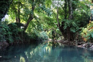
Continuing along the coast (to the east), you will cross over a bridge that spans Kiliaris river, which meets the Gulf of Souda a few meters down the stream. About 200 meters after this bridge, turn right (southwest) on the first junction you will meet and again right (west) once you reach the old highway, 400 meters away. Follow this road until the next bridge, cross over it and turn immediately after it to the left (west), following a curvy dirt road that follows the west bank of Kiliaris river all the way to Stylos (note you should be walking against the flow). About 2.3 km up this road you will reach the small chapel of Agios Ioannis Rigologos at Platanakia. On your way, you should find two rest areas and two springs with fresh, clean water to refuel.
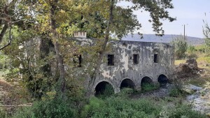
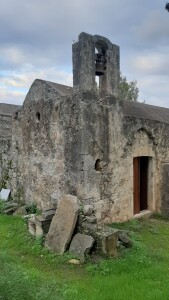
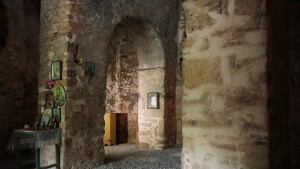
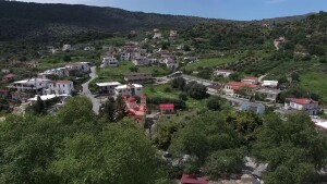
From Platanakia head back to the river and continue along it (to the south), passing by (but not over) an old bridge and continue straight on the next junction which has a Ψ shape (Depending on the time of the year there might be water flowing on the road. If so, walk carefully). Once you pass the creek continue straight until the next junction for 300 meters and then turn left (southwest), looking for the old Venetian watermill of Stylos, also known as the Monks’ Mill (Milos ton kalogeron). From here follow the signs to Stylos, which is only 1.5 km away (to the southwest). At the northern entrance of the village you will find the interesting church of Agios Ioannis Theologos and Agios Nikolaos, built in the 13th century, inside which excavations have revealed the traces of an older one dating back to the 7th or 8th century. Continuing on to the center of the village you will meet the famous springs (pigés) of Stilos, where you can rest or resupply and continue on Part B heading towards ancient Aptera.
PART B: Length 5.3 km, estimated time 1h 50΄
Stylos - Panagia Zerviotissa - Minoan tomb of Azogyre - Aptera - Subashi Tower
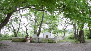
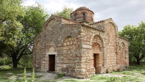
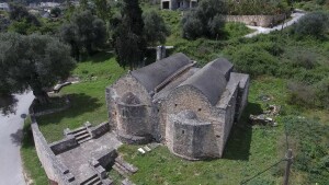
Starting from Stylos (or continuing from Part A), head north along the asphalt road to Aptera - Megala Chorafia. About 450 meters after the factory of ET.AN.AP and the church of Agios Ioannis the Theologian and Agios Nikolaos (on your left as you exit the village), turn right (northeast) on a dirt road. After walking for about 270 meters on it you will meet a fork, follow its left branch, cross the stream and continue straight at the next crossroads. About 400 meters away turn right (to the east), in order to visit the church of Panagia Zerviotissa, which was named so because Virgin Mary is depicted holding Christ on her left side (zervá is left in the Cretan dialect). The church was built in the 10th century and is also known as Monastira, due to its impressive size.
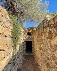
Return to the main path the same way (for about 200 meters) and turn right (north) towards Aptera. When you meet the asphalt road, cross over it and continue opposite on a dirt road (for 140 meters), turning left (north) at its end. About 140 meters further on this road turn right for another detour, which will lead you to a Minoan vaulted tomb at a location named Azogyre(s). Excavations that have taken place on the hill further east revealed the remains of a Minoan settlement which used to control the western side of the Kiliaris valley, but was abandoned during the Late Minoan period (1560-1050 BC).
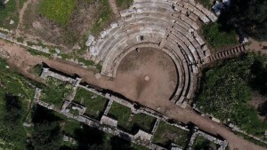
Return to the road and turn right (east) after about half a kilometer, following a dirt road that narrows into a path after 800 meters. This path leads after about 1 km to the south gate of the ancient city of Aptera, which was founded during the late Geometric years (760-700 BC) and flourished during the Classical and Hellenistic periods. To the northwest of the gate and inside the archeological site you can see the ancient theater, a Roman mansion and the small monastery of Agios Ioannis Theologos, but signs will lead you to the right (northeast), along the southern wall of the ancient city (from the inner side). Following the path, you will see a mitato (Cretan shepherd’s hut) and traces of fortifications, reaching the Tower of Subashi about 1,2 km away. This tower (kule) was built during the late Ottoman period to reinforce the defence of the area, completed by Fort Itzedin to the north and Fort Souda (both visible from the tower). This is where Route 1 ends, rewarding the trekker with an impressive view over the entire Gulf of Souda, Akrotiri and most of Apokoronas, with Drapanokefala dominating the horizon to the east and the White Mountains (Lefka Ori) to the south and southeast.
Source: Municipality of Apokoronas (2022)


