


Paths of Apokoronas (Route 2)
Route 2: Α journey through History
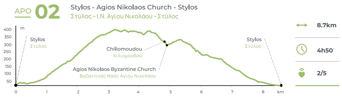
Stylos - Kilindra - Monumental olive tree of Samonas - Chiliomoudou - Kyriakosellia (fort) - Agios Nikolaos church - Provarma - Stylos
Total length of route 2: 8.7 km, estimated time 4h 50΄
Part A: 5.6 km, estimated time 2h 35΄
Stylos - Kilindra - Monumental olive tree of Samonas - Chiliomoudou
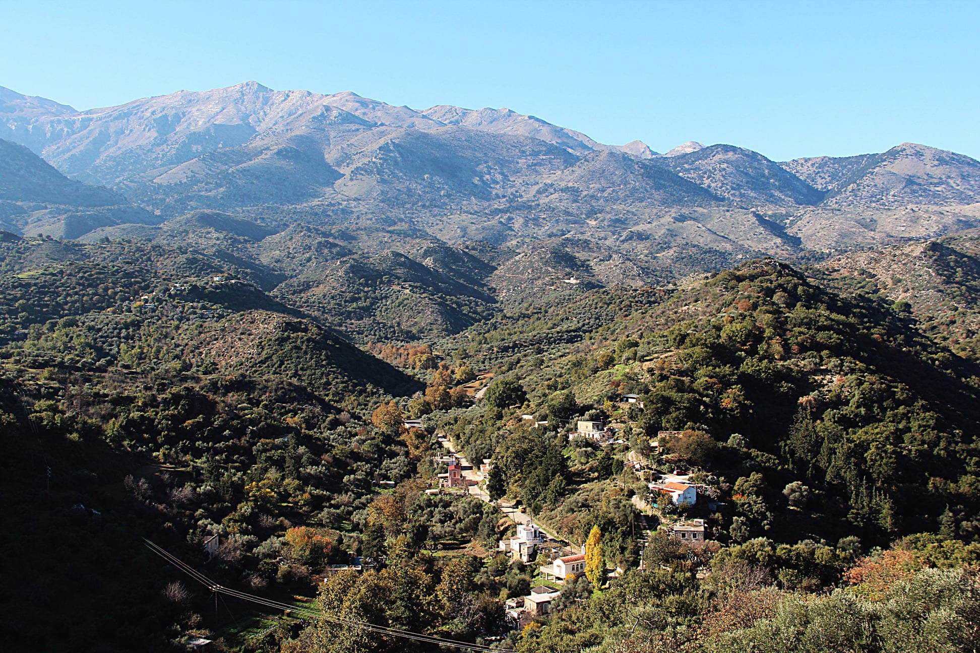
Route 2 has been designed in order to promote the hinterland of Apokoronas, mainly the upper part of the Kiliaris valley, taking as reference points the monumental olive tree of Samonas, the fort of Kyriakosellia and the Byzantine church of Agios Nikolaos. From the springs of Stylos and the church of Agios Ioannis Theologos head west (uphill) and at the second crossroads after 150 meters turn left (south) and at the next junction right (southwest). Continue on this road for about 200 meters and turn right (west) at its end. About 270 meters further down this street, near the last houses of the village, turn right (northwest) follow a dirt road that narrows into a path some 800 meters above. After another 400 meters the path intersects a dirt road and continues even further uphill, to a location named Kylintra (1 km), at an altitude of 360 meters outside Samonas.
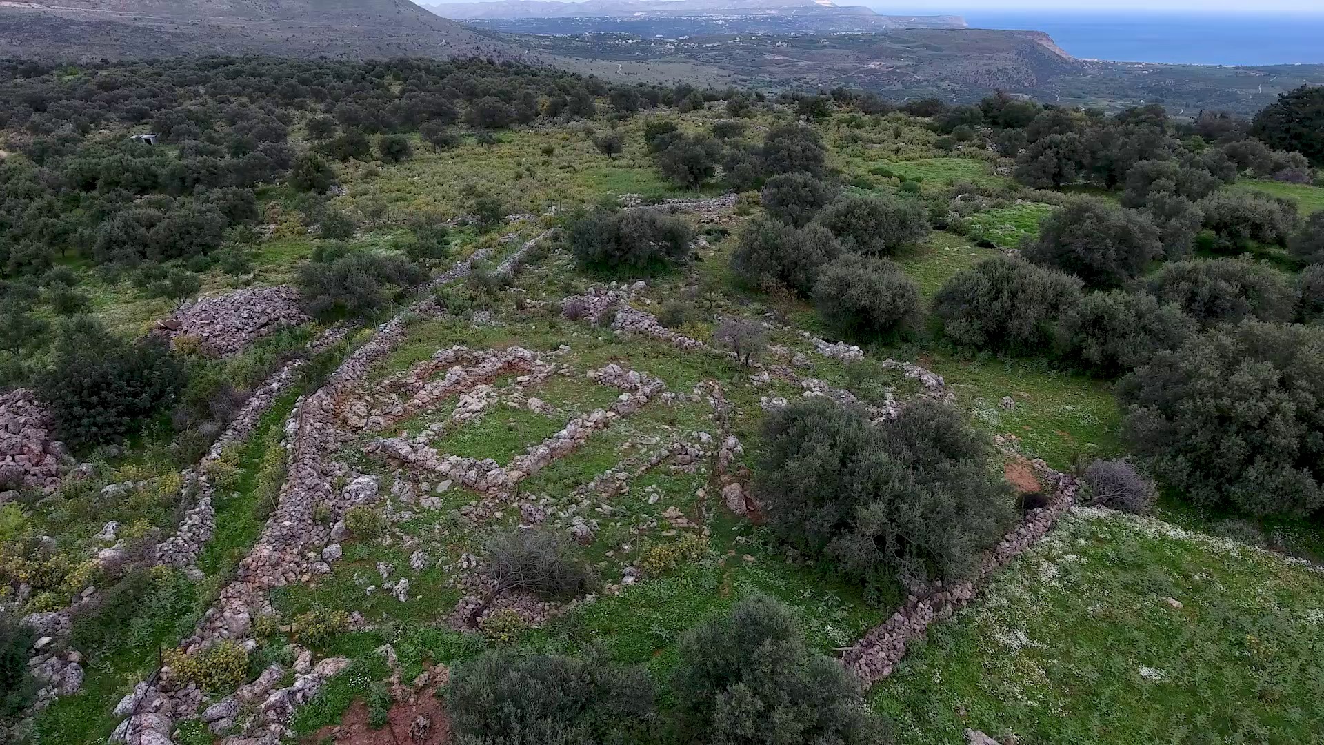
Archeological excavations have revealed traces of a settlement of the Late Minoan period (1560-1050 BC), tools and ceramics in this area. The strategic location of the hill shows there must have been a citadel here. According to Paul Faure, the name of the village Samonás has derived from the word “samos” or “sami”, which is often used to describe a steep place in high altitude. According to another theory, the village’s name is related to Samonas of mythology, son of Hermes and Rhene, while a third connects the village to Agios Samonas, to whom the locals have dedicated the right aisle of the church of Agios Efstathios, situated at the highest point of the village.
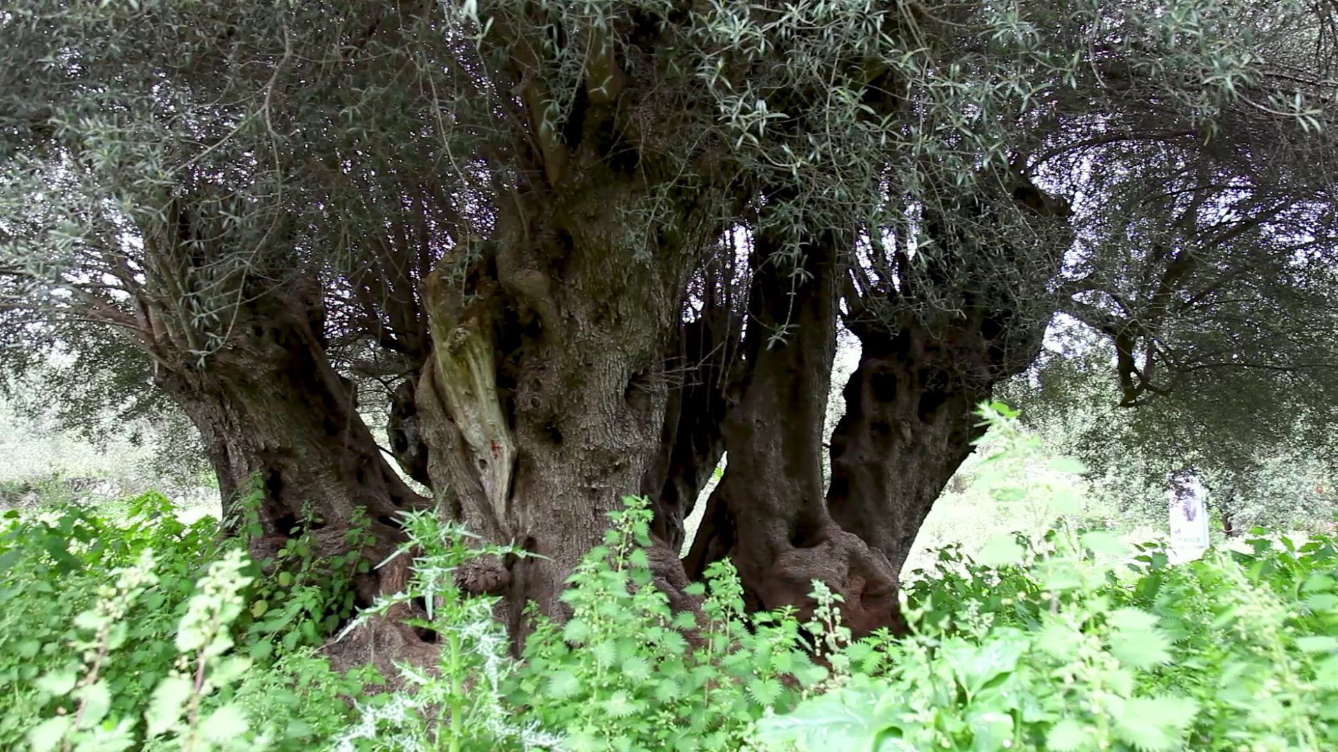
Before continuing to Samonas, it’s worth visiting the Monumental Olive Tree of Samonas, located at a site named Lakkos, about 700 meters from Kylintra. This olive belongs to a variety known as “tsounati” by locals and has been declared “monumental” by the Association of Olive-producing Municipalities of Crete, due to its age and size. At a height of one meter from the ground, the trunk of the tree has a maximum diameter of 5.25 meters and a perimeter of 12.90, while at its base it has a maximum diameter of 6.70 meters and a perimeter of 20 meters.
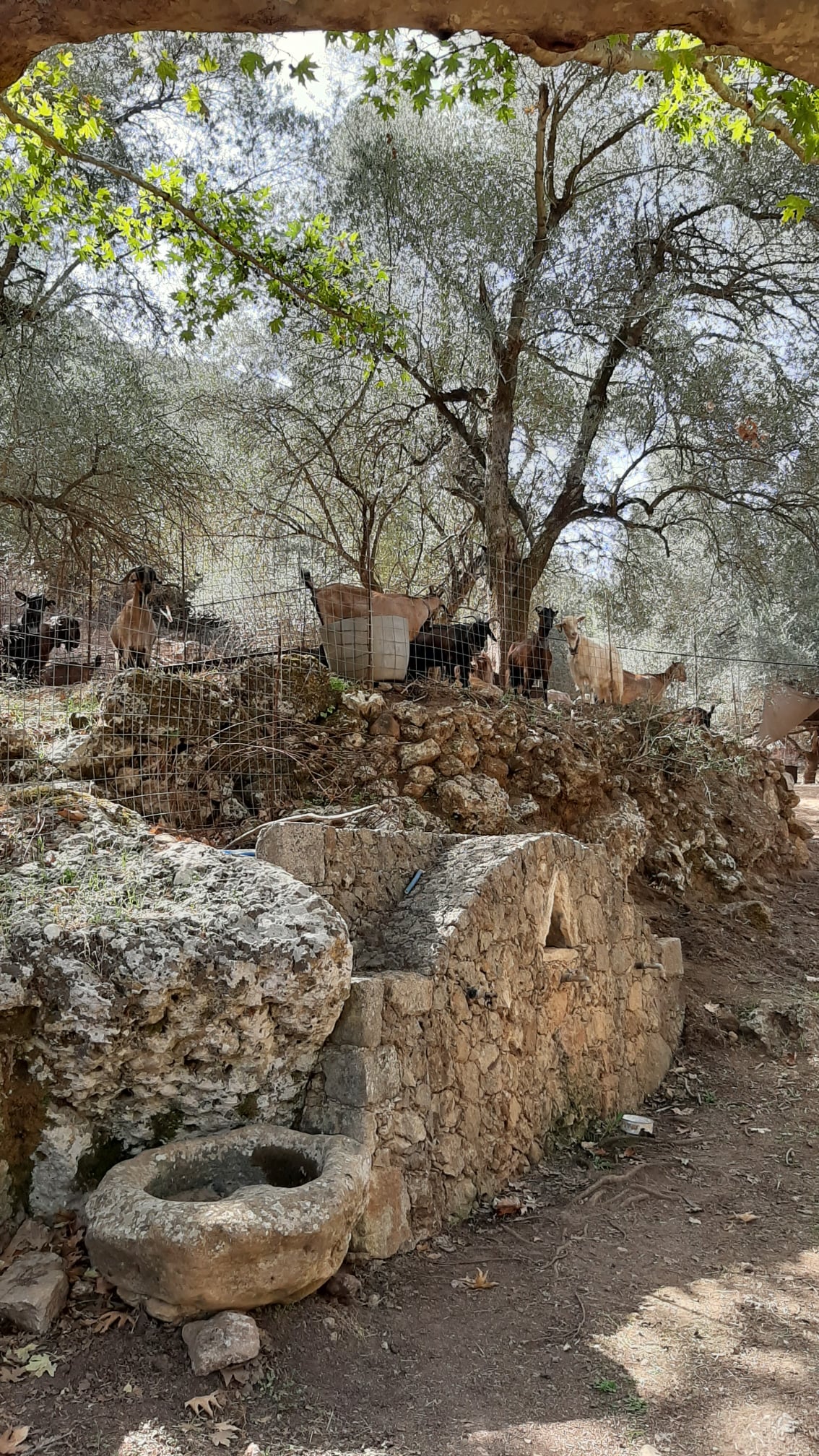
Continuing southwest from Samonas and at a distance of about 1.5 km you will find Chiliomoudou, a small village that holds tight on tradition, as here you can find the only olive mill in Greece that still operates in the traditional way (with mills and torvades), one of last workshops of Cretan musical instruments (which makes lutes, violins, mandolins and lyres) and one of the few workshops that still make sheep and goat bells, known as “léria” among Cretans.
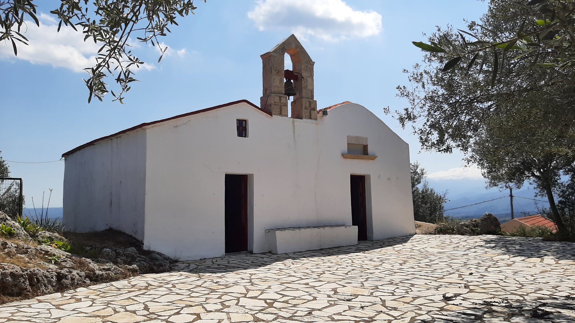
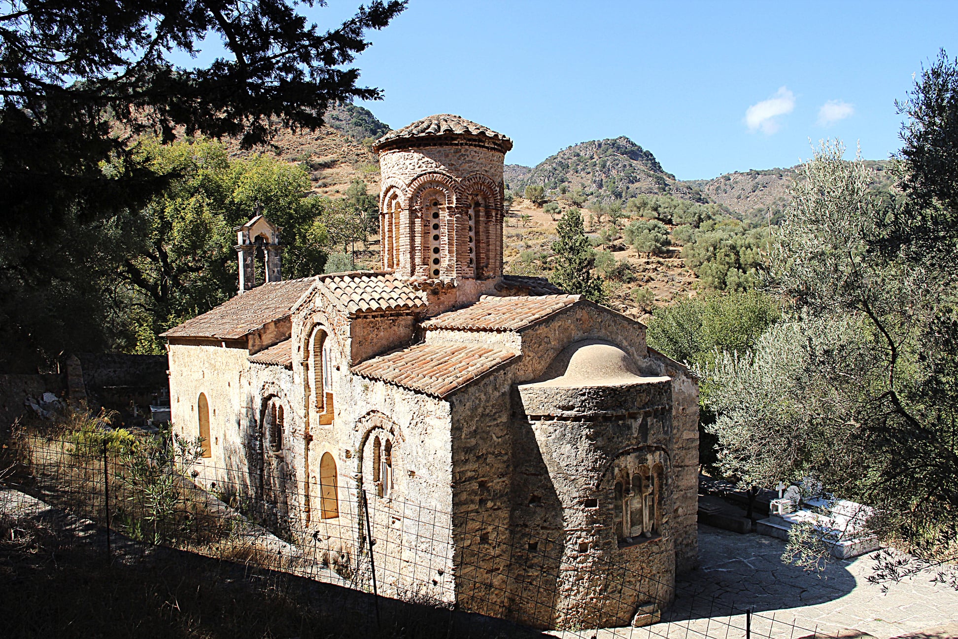
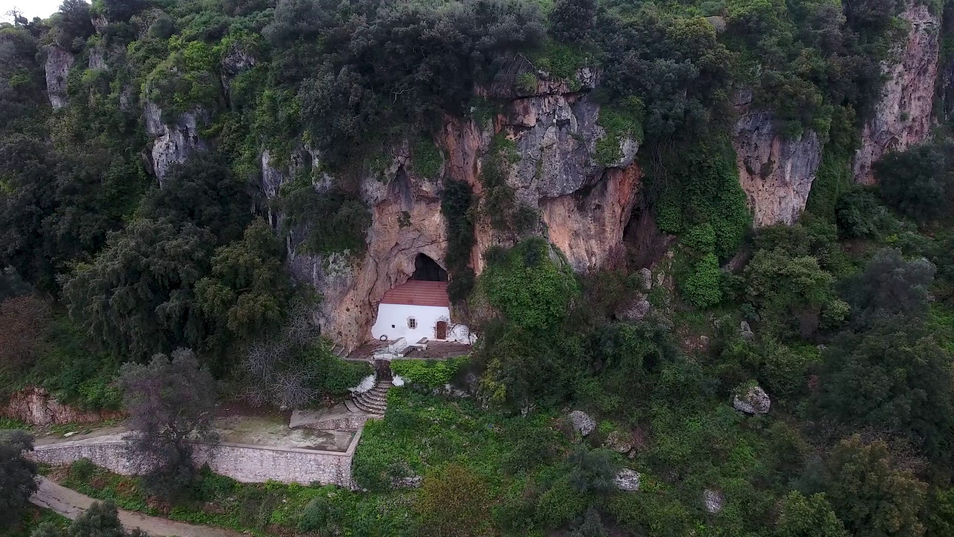
From Chiliomoudou you can descend the slope south of the village and continue to the Byzantine church of Agios Nikolaos (800 meters away), one of the most beautiful and well-preserved in Crete.
Part B: 5.1 km, estimated time 2h 15΄
Kyriakosellia (fort) - Agios Nikolaos church - Provarma - Stylos
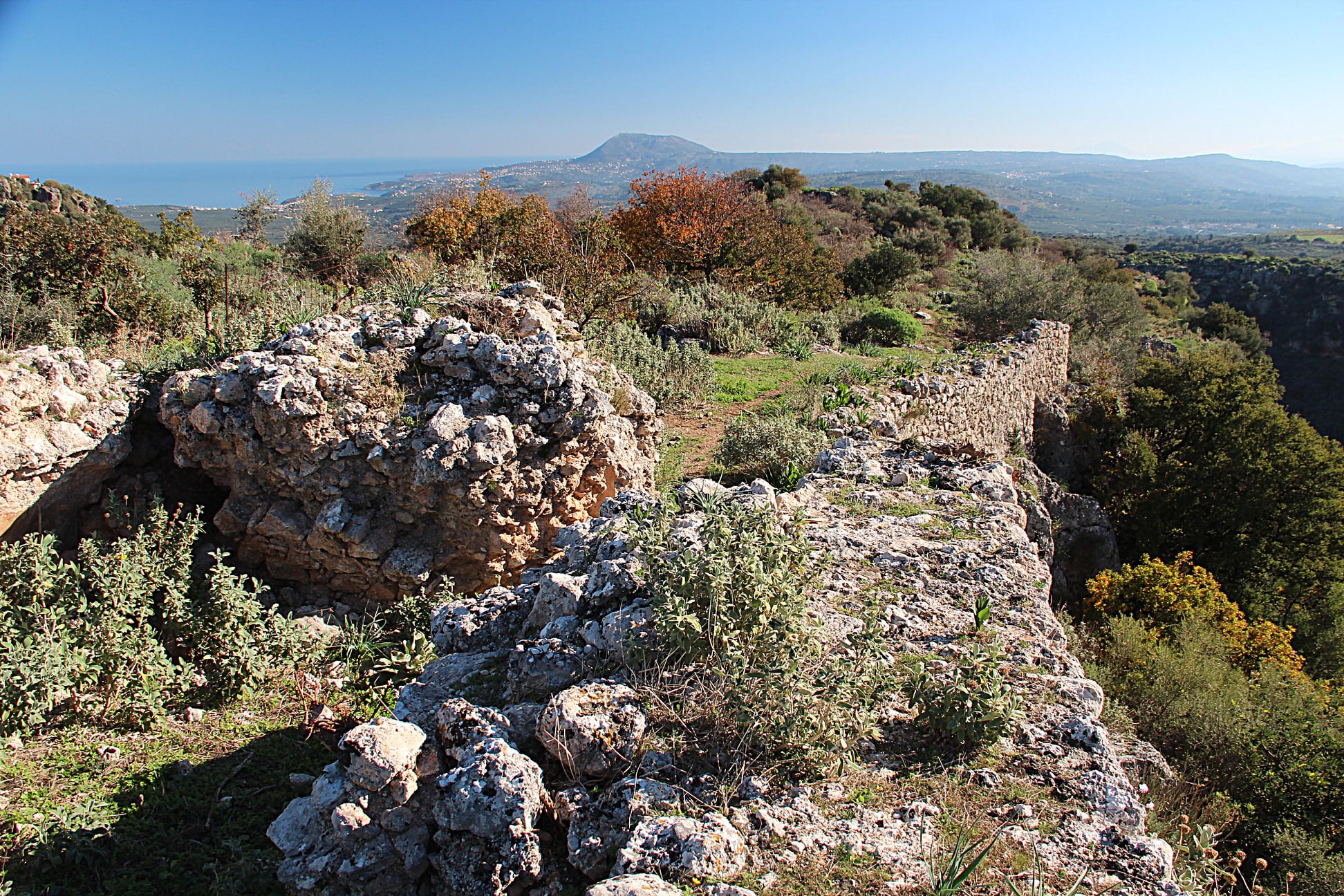
If you walk this as a circular route (starting from and heading back to Stylos) and you have already walked Part A, you should have reached the Byzantine church of Agios Nikolaos descending from Chiliomoudou (800 meters away). If not, you could start your walk from Kyriakosellia, a small village that is said to have taken its name from the word for “saddle” (séla), or from the Cretan word “seli”, often used as a byword for mountain pass. When Enrico Pescatore occupied Crete in 1205 in the name of the Republic of Genoa, the fortress of Kyriakosellia (Rocca di San Nicoló) was one of the fifteen he chose to repair, but this did not prevent it from falling to the Skordili and Melissini families, who occupied it during the revolution of the two Sivriti in 1217 and kept it until 1236, when they handed it over to the Venetians by treaty (in exchange for some privileges). Inside the fort one can find the church of Agia Paraskevi, while at the western end of the castle there is a tower and a water tank.
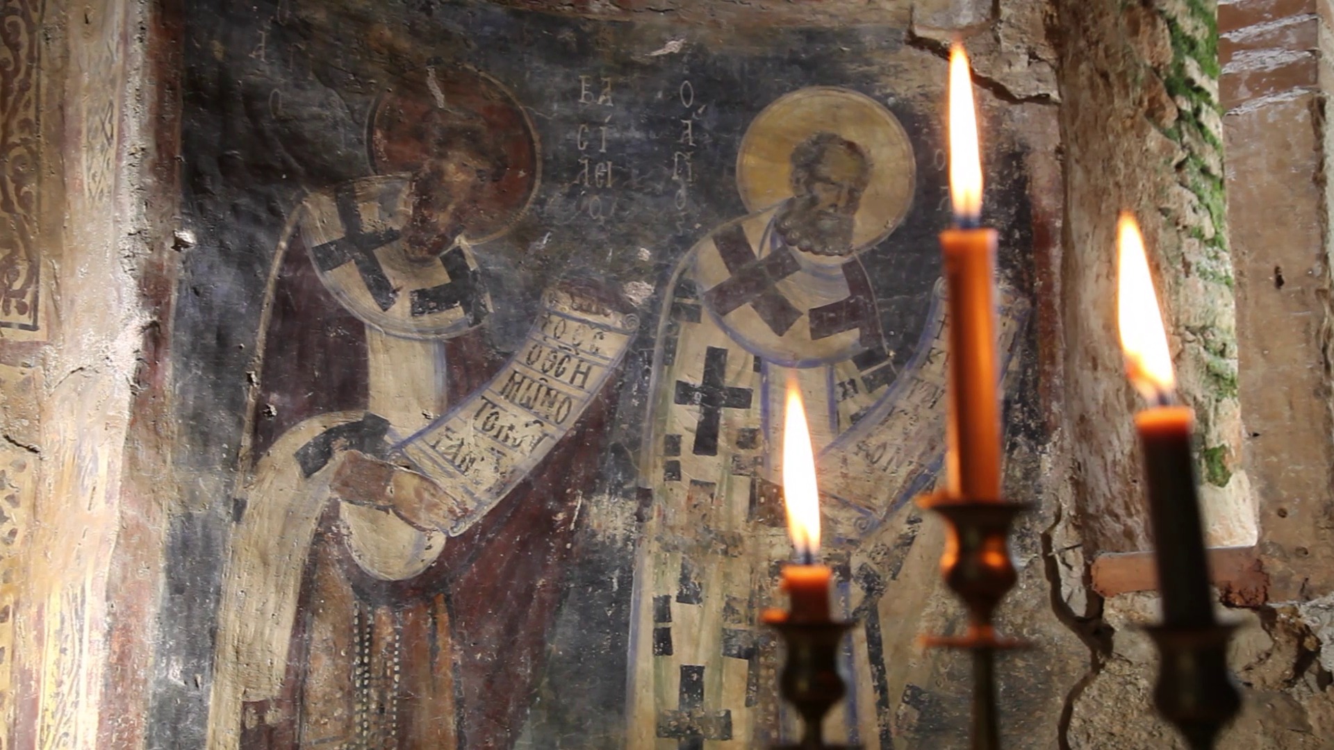
Below the fortifications on the north side of the rock is the church of Agios Mámas, while lower in the valley (north of the castle or northeast of the village) is the church of Agios Nikolaos, one of the most beautiful and well-preserved Byzantine churches in Crete. The church was initially built in the 11th century as a single-aisled vaulted structure, but was later turned into a cruciform church with a dome in the 13th century. During the same period, its interior was decorated with excellent frescoes, many of which are still in good condition.
From here take the road to the north and then to the east for about 800 meters and turn right on a path below Chiliomoudou, walking as much until you cross the road that connects Samonas with Provarma. Cross the road and turn left (northwest), walking on a short path next to the street for about 300 meters. Then turn right on another dirt road that turns into a path for about 600 meters. Many places on this route have impressive views to the valley of Koiliaris. From here, you may follow the main road and visit Provarma, otherwise follow the signs and turn left (north) a bit before the village, walking for about 1 km on a dirt road that leads you to the outskirts of Stylos, about 500 meters from the springs.
Source: Municipality of Apokoronas (2022)